
Where We Are Located
Mana Manu conservation project covers 316 hectares of land on the western side of Whangapoua Harbour.

A diverse coastal environment
The conservation area is made up of 27 privately owned blocks of land which feature regenerating native bush plus freshwater estuarine, and saltwater marsh environments. The Kaipapaka stream forms a watershed on the north side which smaller streams feed into. The Horongaherehere stream forms part of the southern boundary of the conservation area.

The east facing hills and ridges look out to the Whangapoua Harbour, Matarangi spit, Kuaotunu and Opito Bay and the Mercury Islands in the distance.

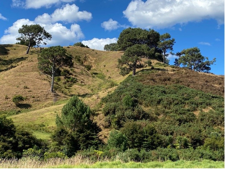
Panorama of Mana Manu conservation area
Ancient podocarp forest
The ancient volcanic origins of the land are evident in the backdrop of Castle Rock (Motutere) and the headlands and islands of the Whangapoua harbour and beach area.

Like most of the Coromandel, the western side of the Whangapoua Harbour was once a dense podocarp forest and lowland broadleaf forest dominated by kauri. Pre-colonisation, Coromandel kauri were said to be some of the largest in New Zealand. The forest was alive with the sights and sounds of native birds such as kiwi, tui, bellbirds, kereru and kāka. The low-lying wetlands at the base of the hills were home to bittern and pateke. Reptiles, insects and an abundance of fish and shellfish thrived in the lush environment.

Rich food source for early Māori
The fertile harbour, estuaries and deep forests provided a rich environment for early Maori, the first inhabitants. The Whangapoua area became home to Ngati Huarere, descended from Tametekapua, Chief of the Arawa canoe. There is still a remnant pa located towards the western boundary of the Mana Manu conservation area and contact with Ngati Huarere today.

Logging and farming
The habitats, which evolved over millions of years, first came under threat when the highly valued kauri were milled in the 1880s. About forty years later, much of the native bush was cleared for farming, mostly by burning off. By the middle of the twentieth century, the only remaining evidence of the once majestic podocarp forest were remnants of virgin natives including kauri, tanekaha, kahikatea, rāta and puriri on the ridges and in the valley and pohutukawa on the coastal edges.
The land proved to be economically unsustainable for sheep and beef farming so stock were removed in the 1980s and the hills left to regenerate. After resource consents to burn off the scrub were denied in the early 2000s, the land was subdivided and sold off.

Conservation and protection
The rolling hills, streams, estuaries and marshes on the western shores of the Whangapoua Harbour were identified as having significant indigenous biodiversity when a change of land use was considered. The Thames Coromandel District Council (TCDC) designated the area a conservation area making it a priority for ecosystem restoration and giving it a number of protections.
Two of the blocks within the conservation area were also vested in the QEII National Trust through the subdivision process. This guarantees that the native biodiversity on these blocks is protected in perpetuity.

Regeneration and the return of biodiversity
Once the area was no longer grazed, mānuka and kānuka quickly reestablished. The remnants of indigenous trees such as kauri, rimu, kāhikitea, tanekaha, miro, rata, puriri, nikau, pukatea and pohutukawa provided an important source of seed for the regenerating bush allowing these species to once again take hold.

Landowners have contributed to the re-establishment of the indigenous landscape by planting thousands of native plants both in gardens and in the bush.